Storm Chances Arriving Soon

A warm and breezy day is expected, but storm chances could soon return to the metro.
Here are the details from News On 6 Meteorologist Alan Crone:

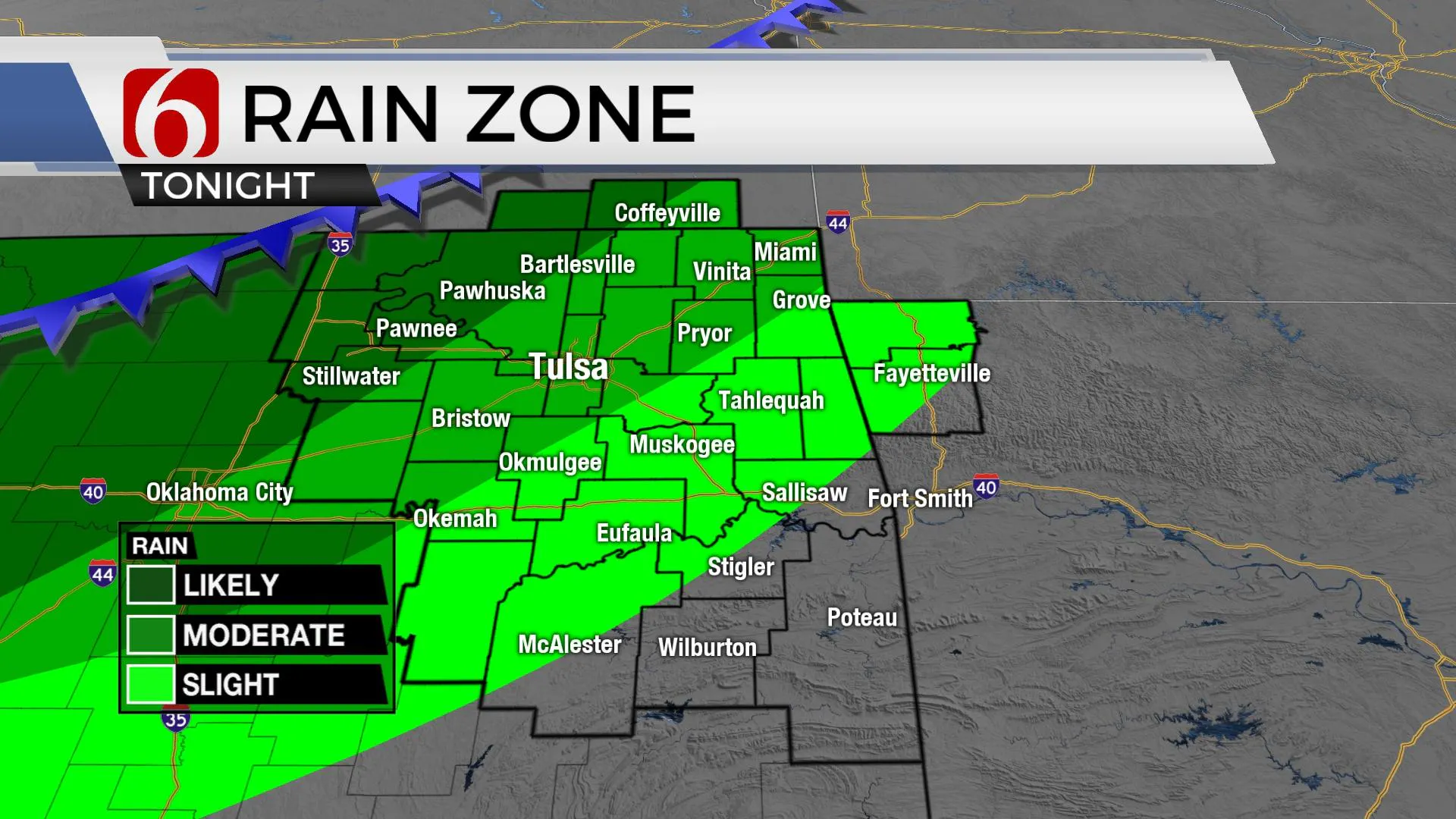
A powerful upper-level system is ejecting into the northern high plains on Tuesday morning with a slow-moving cold front entering central and southern Kansas. This front will move into part of northern Oklahoma later Tuesday night with increasing thunderstorm chances near and ahead of the boundary. A very small chance for a few storms will remain Tuesday morning along the OK-KS state line region, but higher chances occur later Tuesday nights.
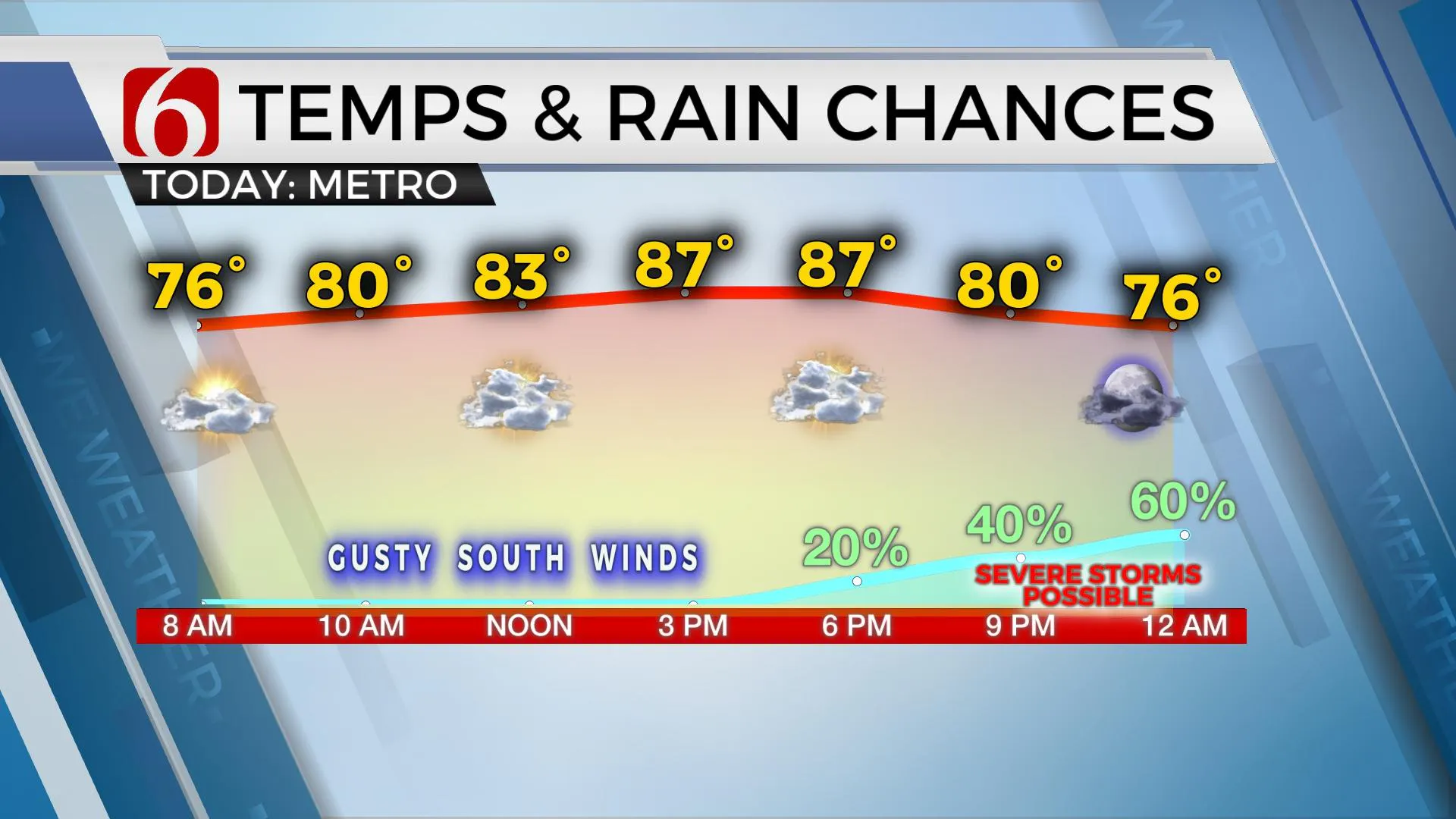
Some of the storms will be severe with primary threats of very large hail and damaging winds. The tornado threat remains low but not zero. The timeline for severe weather threats will be approximately 7 p.m. to midnight with a small window also existing into pre-dawn for some locations. The front is expected to stall near or slightly south of the metro Wednesday morning with additional storms developing through the day as additional forcing arrives from the west. A few of these may also be strong to severe on both sides of the boundary. A flood watch will be posted for part of northern OK and southern Kansas starting tonight through Wednesday.

After Wednesday midday the front will begin moving slowly southward. Additional storm chances will remain Thursday and Friday, but higher probabilities will be expected across southern sections, closer to the boundary. The upper air flow later this week will be mostly zonal with a slight tilt from the northwest. This may bring another complex near the area Friday night into Saturday and Saturday evening into early Sunday. The overall pattern will remain quite active through early June with additional storm chances across the state.

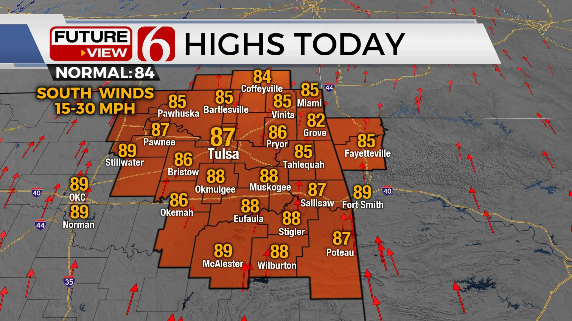
Temps today will reach the mid to upper 80s with south winds at 15 to 30 mph. North winds arrive Wednesday with highs in the upper 70s and lower 80s. Thursday brings the coolest afternoon with highs in the lower 70s. South winds return Friday afternoon and will continue through the weekend with temps nearing or slightly higher normal.
Thanks for reading the Tuesday morning weather discussion and blog.
Have a super great day!
Alan Crone
KOTV
If you’re into podcasts, check out my daily weather update. Search for NewsOn6 and ‘Weather Out The Door’ on most podcast providers, including Spotify, Stitcher and Tune-In, or Click Here to listen on Apple Podcasts.