Pattern Change Brings Weekend Storm Chances
More heat returns to Green Country on Friday before storms chances return for the weekend.
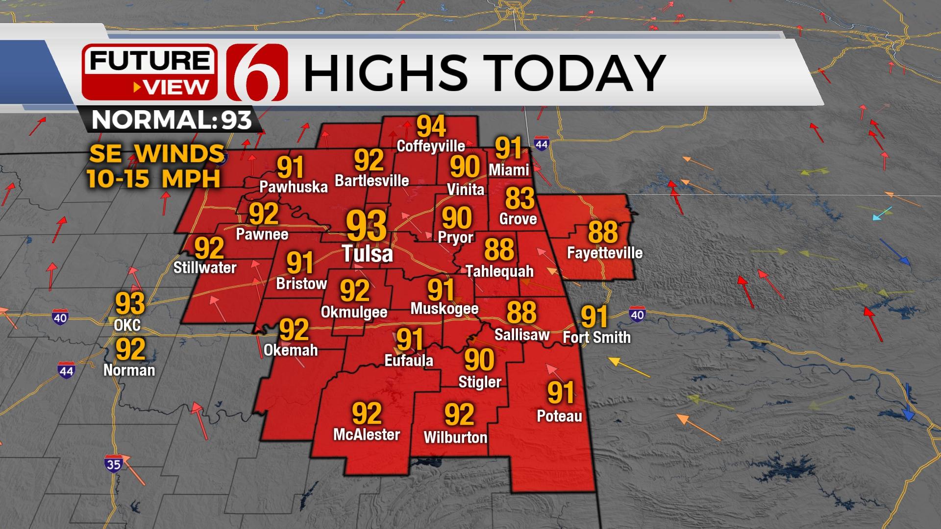
Here are the details from News On 6 Meteorologist Alan Crone:

South winds return Friday with afternoon highs reaching the lower 90s in the metro and upper 80s across far eastern Oklahoma. The pattern supports mentions of scattered showers and storms nearing the northern third of the area later tonight into Saturday. Another system will approach the area Sunday providing higher chances for showers and storms, but locations to the southwest and south of the metro will have the highest chances for the Sunday system. This system may linger across or near the southern OK area early next week.

A weak front enters Kansas this afternoon and evening with thunderstorms. Most of this will remain north. But a few storms may migrate into northern OK pre-dawn Saturday with a residual outflow dropping near the state line region. We’ll keep a low chance for a few scattered storms early Saturday.
Saturday afternoon a slightly stronger disturbance approaches and overruns the area. The weak boundary positioned near northern OK may provide a focus for a few strong to severe storms Saturday afternoon and evening, mostly across far northeastern OK into SE Kansas, SW Missouri, and NW Arkansas.

We continue to forecast our next meaningful system nearing the state Sunday that should have some influence with additional rainfall for part of the area. We’ll keep a moderate chance for activity near the metro Sunday, and higher chances, including some localized flooding or drainage problems across the southern sections of the state. The data continues to shift higher concentrations of rain areas mostly to the south of the metro, but we’ll need some moderate chances for our area Sunday. This system will bring highs in the upper 70s and lower 80s for the afternoon.

The upper pattern is transitioning, bringing more of an active flow across the Midwest and across part of the southern plains for the next two weeks. This will occasionally bring periods of below normal temps followed by additional warming trends.
Thanks for reading the Friday morning weather discussion and blog.
Have a super great day!
Alan Crone
KOTV
If you’re into podcasts, check out my daily weather update. Search for NewsOn6 and ‘Weather Out The Door’ on most podcast providers, including Spotify, Stitcher and Tune-In, or Click Here to listen on Apple Podcasts.