Strong Cold Front Pushes South with Cooler Temps and Scattered Showers

Rain Gear Tonight?
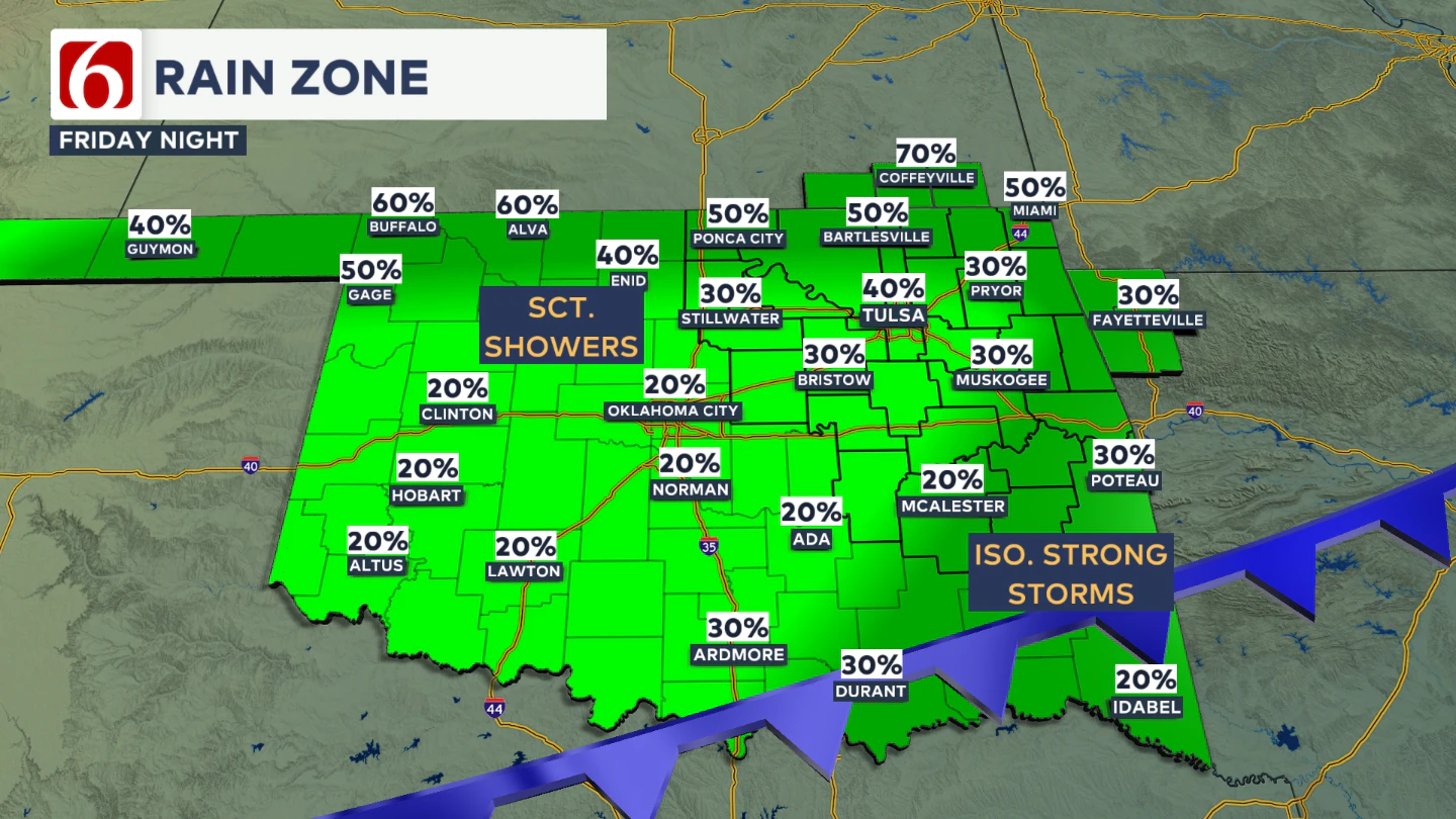
The primary threats will be hail and damaging wind gusts if a stronger storm develops. Storm coverage is expected to remain scattered, mainly across southeastern Oklahoma. The higher threat for severe storms should remain slightly south of the Highway 270 corridor.
Will Saturday Stay Dry?
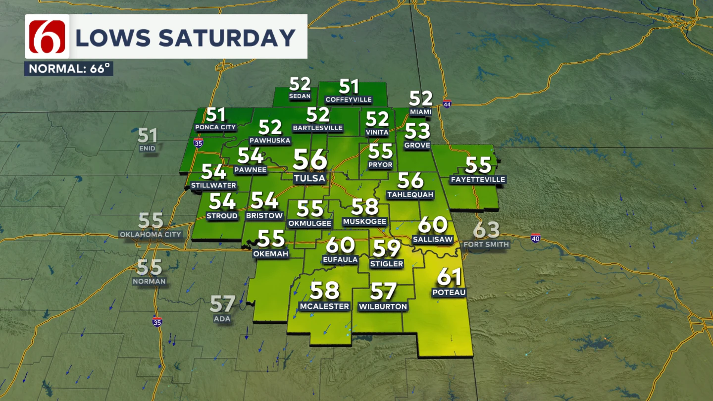
Saturday morning will start cool and very fall-like, with lows dipping into the lower 50s across northern Oklahoma and upper 50s across southeastern Oklahoma.
Afternoon highs will reach the mid 70s across most of the area, with northeast winds around 10 mph.
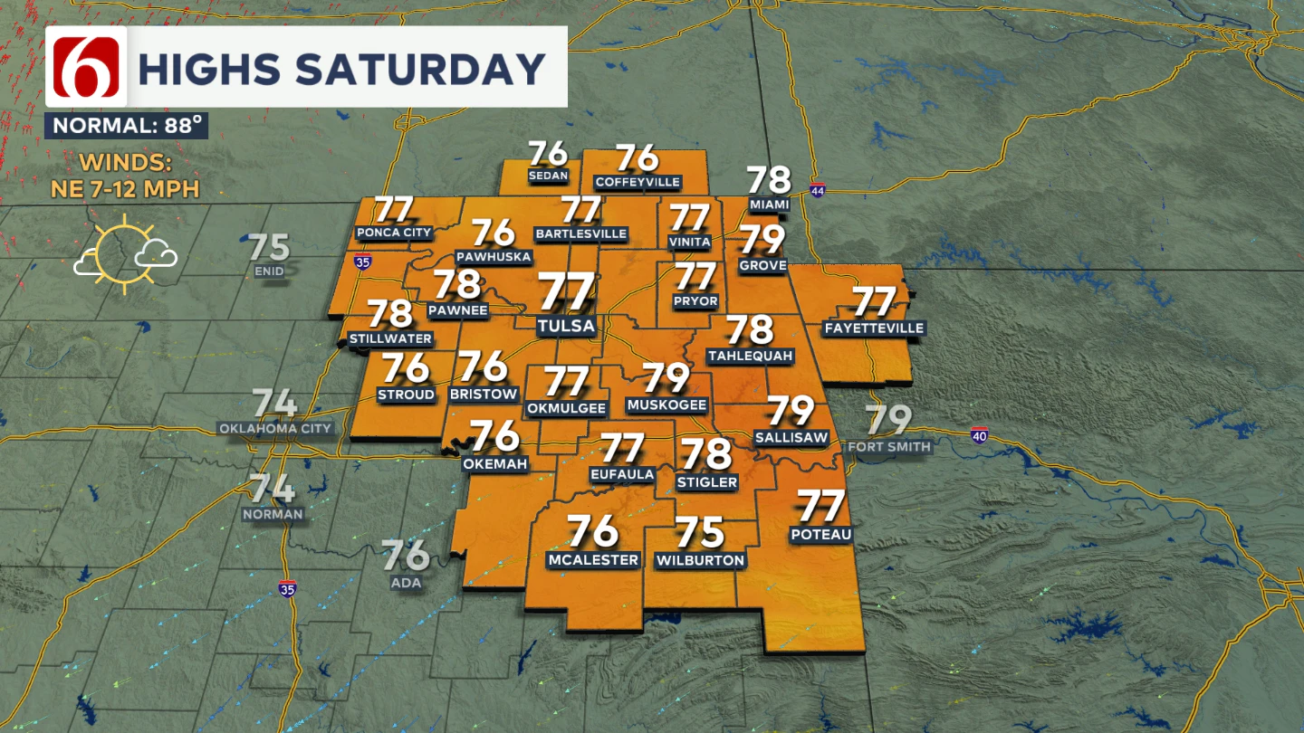
After a slight chance of lingering showers very early, skies will gradually clear during the day Saturday with mostly sunny skies by late in the day.
How's Sunday Looking?
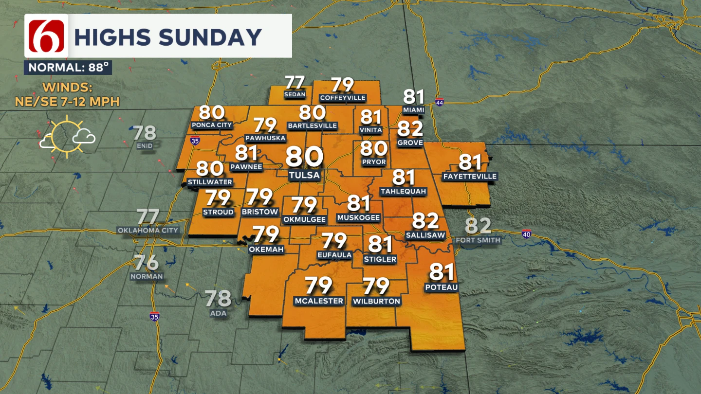
Sunday morning also begins cool, with lows in the mid 50s and highs again in the upper 70s to a few low 80s.
The remnants of Hurricane Lorena continue to track along Mexico’s western coast and will continue to weaken as it moves inland. Moisture from this Pacific system will spread across the northern Mexican Plateau and into parts of Texas Sunday into early Monday.
At this time, it appears that most of this moisture will remain south of our area, so rain chances for early next week stay low, near or below 10 percent.
Does Warmer Weather Return Next Week?
Temperatures will remain cooler than normal through the first part of next week, with morning lows in the upper 50s to lower 60s and highs in the lower 80s.
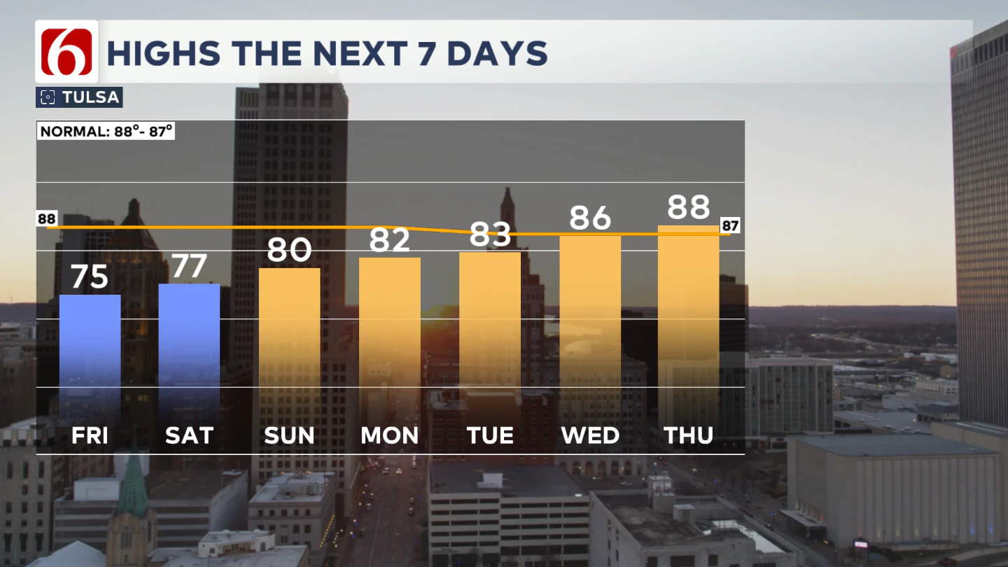
However, forecast data suggests a bigger warming trend by late next week and into the weekend, with highs climbing into the upper 80s and possibly reaching the lower 90s again.
Lake Levels
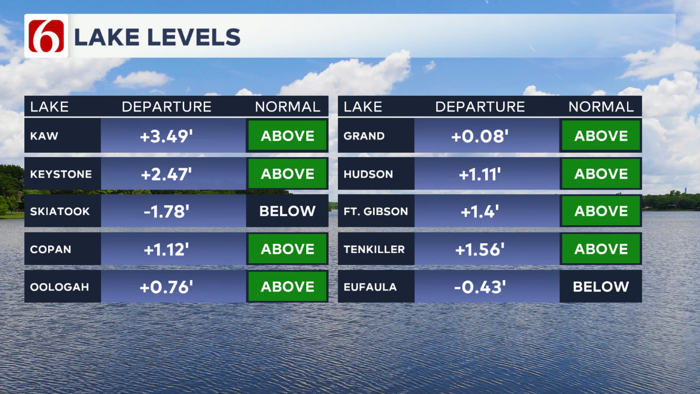
If you're making some lake recreation plans, here's an update on our area lake levels.
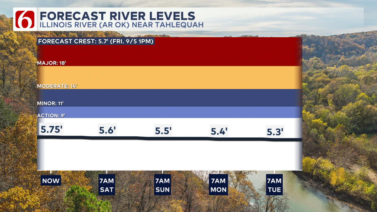
The Illinois River at the Tahlequah gauge
The Morning Weather Podcast:
The daily morning weather podcast briefing will remain on hold indefinitely due to ongoing internal workflow issues.
We're working to resolve these challenges as soon as possible and appreciate your patience. We apologize for the inconvenience and hope to be back soon. Thank you for your understanding.
Hot weather safety:
🔗 Oklahoma heat safety tips: How to spot and prevent heat illness
🔗 Top summer safety tips every family needs to know
🔗 'It can happen to anybody': First responders warn of hot car deaths
Need-to-know severe Oklahoma weather prep:
🔗Severe weather safety: what you need to know to prepare
🔗Tornado Watch vs. Tornado Warning: what they mean and what to do
🔗Severe weather safety: what to do before, during, and after a storm
🔗Why registering your storm shelter in Oklahoma could save your life
🔗Floodwater kills more Oklahomans than tornadoes in the last decade, here's why
🔗'Turn around, don't drown': Flood safety tips for Oklahomans
🔗5 things to know: How Oklahomans can get federal money to install storm shelters
🔗Breaking down the SoonerSafe Rebate Program: Do I qualify for a storm shelter?
Watch us on YouTube
Follow NewsOn6 on X/Twitter for automated severe weather alert posts: @NewsOn6
Emergency Info: Outages Across Oklahoma:
Northeast Oklahoma has various power companies and electric cooperatives, many of which have overlapping areas of coverage. Below is a link to various outage maps.
- PSO Outage Map
- OG&E Outage Map
- VVEC Outage Map
- Indian Electric Cooperative (IEC) Outage Map
- Oklahoma Association of Electric Cooperatives Outage Map — (Note: Several Smaller Co-ops Included)