Record highs possible today before storm chances return to green country

Unseasonably warm weather is expected today, with some locations near and west of the Tulsa metro nearing record highs. Tulsa will see a high near 94° after a morning low of 65°, under sunny conditions. 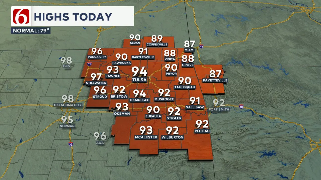 South to southwest winds at 10 to 25 mph will persist, and low-level moisture will be more significant east of Highway 69/75, keeping heat index values in the mid-90s. Areas farther west, with drier air, may reach the lower to mid-90s.
These conditions make record highs a possibility for parts of eastern Oklahoma.
A Weak Front Brings Limited Rain Chances Thursday
Late tonight into early Thursday morning, upper-level flow will help push a surface cold front southward.
This boundary is expected to move through northern Oklahoma early Thursday before stalling across southeastern Oklahoma by the afternoon and evening.
Thursday will feature mostly sunny skies, with a morning low of 68° and a high of 85°. 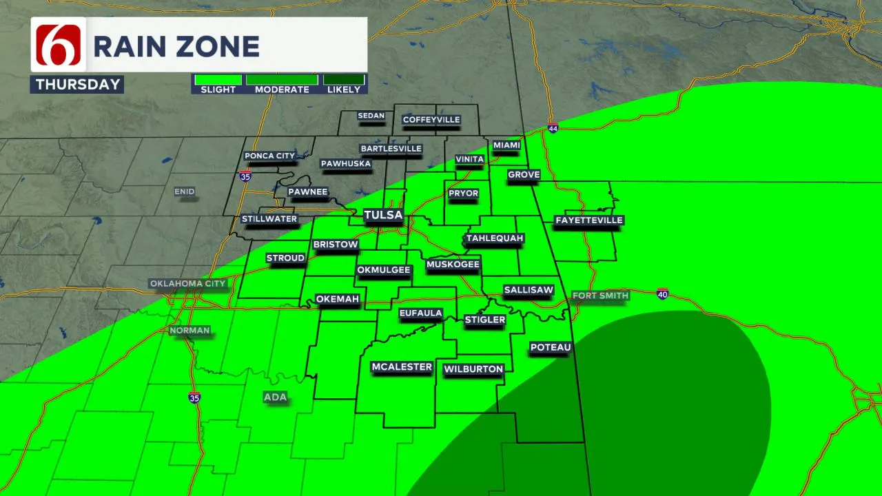 While stronger forcing will stay north and east, a few showers or storms could develop in far southeastern Oklahoma and western Arkansas.
While storm chances are low, any that do form could be strong to severe, with damaging winds and hail possible.
Another Boundary Nears Friday with Isolated Storm Risk
The front may lift slightly northward or become diffuse before another boundary arrives Friday. Friday’s weather will remain partly cloudy, with a low of 61° and a high of 89°. 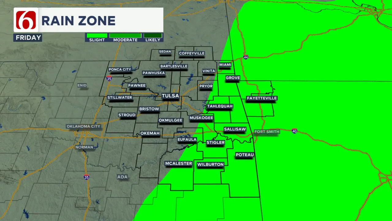 Storm chances remain low, but some isolated activity is possible in extreme northeastern Oklahoma and southeastern Kansas late Friday into early Saturday.
A few showers and storms will also remain possible across far southeastern Oklahoma.
Storm Potential Increases This Weekend
South winds will continue into the weekend, bringing increased low-level moisture. Saturday’s forecast includes partly cloudy skies, with a morning low of 62° and a high of 88°.  A strong upper-level trough developing in the west will shift a boundary northward, and a few storms could develop Saturday night into Sunday.
Some of these could turn strong or severe depending on how the system evolves.
Sunday Holds Higher Rain and Storm Potential
Sunday will begin around 65° and warm to a high of 85°, with partly cloudy skies continuing.
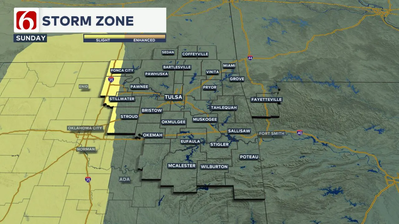 A developing dryline in western Oklahoma and instability from the approaching storm system may allow for scattered thunderstorms to develop, especially Sunday evening into early Monday.
Severe weather threats could emerge as the system strengthens.
Severe Weather Risk Early Next Week
A powerful upper-level system is expected to arrive early next week, bringing multiple waves of instability. This will increase storm chances across Oklahoma, North Texas, and the central Plains. 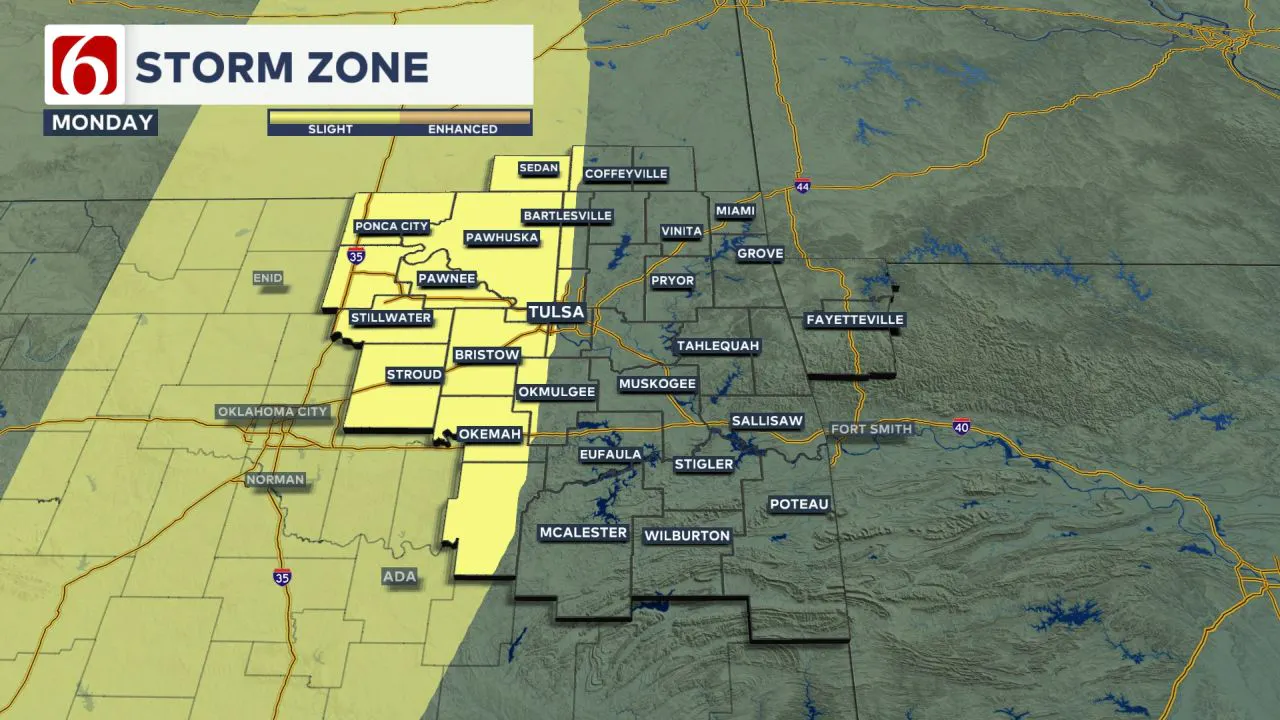 There may be capping from warm air aloft, but the strong storm dynamics are expected to break it down and support storm development.
Cold Front Brings Temporary Relief Midweek
A cold front is likely to move through the area late Tuesday into Wednesday, temporarily clearing out rain and storm chances.
Cooler and drier conditions may briefly follow, but another active pattern could develop behind it.
Stay Weather Aware
As we approach peak severe weather season, staying alert is key. Strong to severe storms are common this time of year across the central and southern Plains.
We’re looking at a weather pattern that could bring a higher chance of severe storms later this weekend into early next week.
While it’s still too early to pin down the exact timing and locations, the setup looks favorable for thunderstorm activity.
We’ll be keeping a close eye on it, and things should come into better focus as we get closer to the weekend
The Morning Weather Podcast:
The daily morning weather podcast briefing will remain on hold indefinitely due to ongoing internal workflow issues.
We're working to resolve these challenges as soon as possible and appreciate your patience. We apologize for the inconvenience and hope to be back soon. Thank you for your understanding.
-----
Need-to-know severe Oklahoma weather prep:
🔗Severe weather safety: what you need to know to prepare
🔗Tornado Watch vs. Tornado Warning: what they mean and what to do
🔗Severe weather safety: what to do before, during, and after a storm
🔗Why registering your storm shelter in Oklahoma could save your life
🔗Floodwater kills more Oklahomans than tornadoes in the last decade, here's why
🔗'Turn around, don't drown': Flood safety tips for Oklahomans
🔗5 things to know: How Oklahomans can get federal money to install storm shelters
🔗Breaking down the SoonerSafe Rebate Program: Do I qualify for a storm shelter?
Hot weather safety:
🔗Oklahoma heat safety tips: How to spot and prevent heat illness
Watch us on YouTube!
Follow NewsOn6 on X/Twitter for automated severe weather alert posts >>>>>> @NewsOn6

Emergency Info: Outages Across Oklahoma:
Northeast Oklahoma has various power companies and electric cooperatives, many of which have overlapping areas of coverage. Below is a link to various outage maps.
- PSO Outage Map
- OG&E Outage Map
- VVEC Outage Map
- Indian Electric Cooperative (IEC) Outage Map
- Oklahoma Association of Electric Cooperatives Outage Map — (Note: Several Smaller Co-ops Included)
Follow the News On 6 Meteorologists on Facebook!