Nice Break From The Heat
A pleasant afternoon with cooler temperatures and lower humidity is expected as green Country gets a break from the summer heat.
Here are the details from News On 6 Meteorologist Alan Crone:

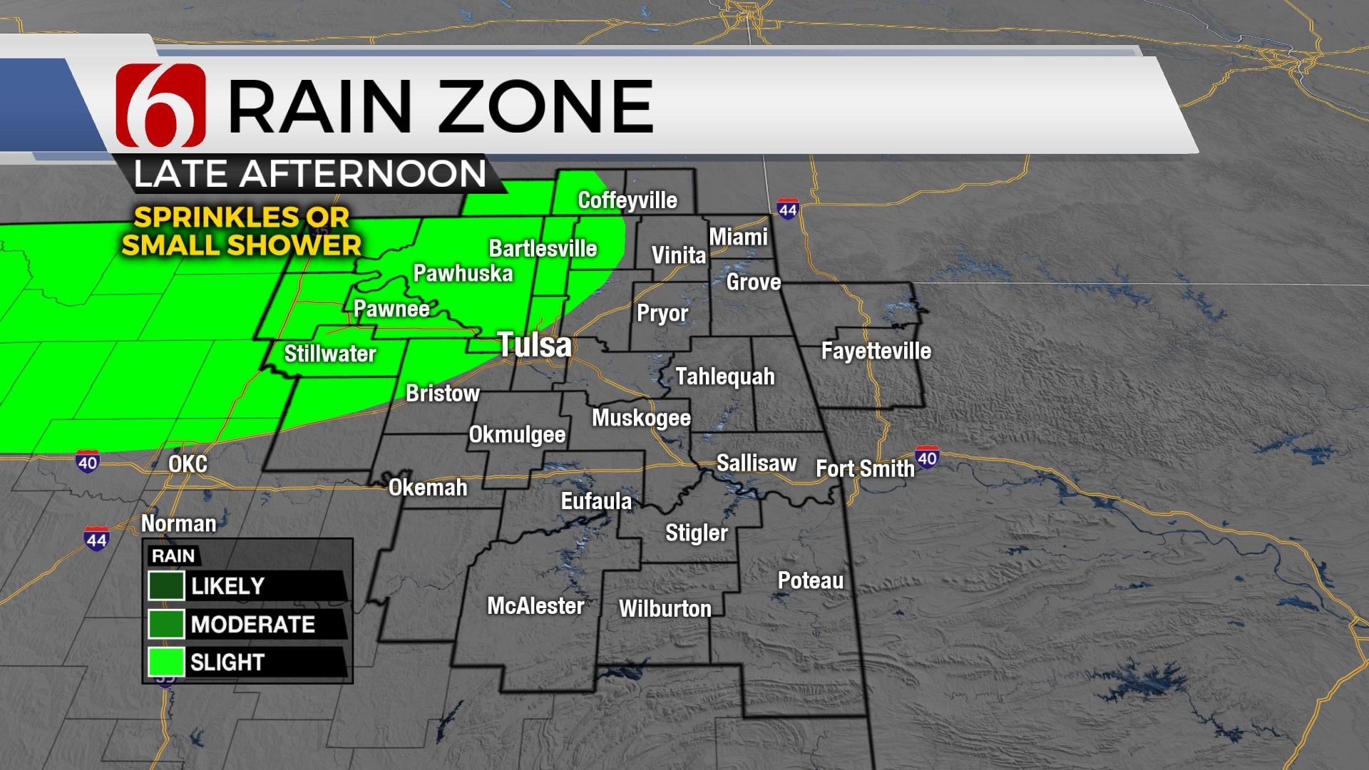
The unseasonably cool weather will remain for the next few days before warm and muggy weather returns into the latter half of the week. A few scattered storms will be possible across far southeastern OK early Monday morning. A few stray sprinkles or small showers will be possible later Monday afternoon and evening across northern OK as a weak disturbance brushes the state. Friday into the weekend, a frontal boundary will sag southward from the central plains while a compact upper-level disturbance arrives from Texas. These features will bring scattered storm chances into the state for the weekend.

Partly cloudy and cool weather is underway this morning. Many locations across northeastern Oklahoma will start in the mid-60s for morning lows with southeastern OK in the lower 70s. Northeast winds from 10 to 15 mph combined with the drier air mass will present afternoon highs in the lower to mid-80s with not heat index issues. These same overall conditions are expected Tuesday with slightly higher daytime max readings with mostly northeast winds. Wednesday will be a transitioning day as southeast winds return and the eventuality of warmer and muggy weather sneaks back into the state.

Thursday and Friday increasing low level moisture from the Gulf will bring heat index values back into the mid and upper 90s while afternoon highs reach the mid-90s. A developing upper-level wave in the Gulf will move onshore Wednesday evening and Thursday morning and continue a general northward trajectory into the weekend. This should bring some scattered storms across part of the area either late Friday night or Saturday. A weak boundary across central Kansas will sag southward with additional scattered storms Saturday into part of Sunday. This front is expected to clear the area Sunday with northeast winds but not major change regarding heat and humidity. The early outlook for the 4th of July features highs in the lower 90s with a slight chance of a shower or storm.

Thanks for reading the Monday morning weather discussion and blog.
Have a super great day!
Alan Crone
KOTV
If you’re into podcasts, check out my daily weather update. Search for NewsOn6 and ‘Weather Out The Door’ on most podcast providers, including Spotify, Stitcher and Tune-In, or Click Here to listen on Apple Podcasts.