Unmanned Aircraft Helps Scientists Study The Climate
A small airplane that's been buzzing over north-central Oklahoma is there for an important reason. It's helping scientists chart changes in the atmosphere.
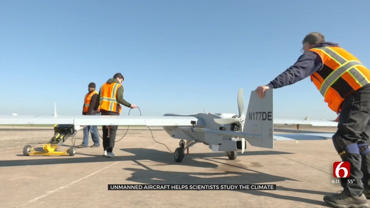
The Pacific Northwest National Laboratory operates the unmanned aircraft for the Department of Energy, flying out of the Blackwell-Tonkawa airport in Kay County.
The aircraft carries a payload of instruments that sample air, giving scientists data they can’t get on the ground or from satellites.
“We're definitely measuring some things you cannot measure from the ground,” said Dr. Beat Schmid, the leader of the Atmospheric Sciences research group that utilizes the airborne instruments. He said that includes “the chemistry of particulate matter, what we call aerosols, aerosols aloft.”
Their target is the airspace over the Department of Energy Atmospheric Radiation Measurement Program, Southern Great Plains Site, in Grant County.
“We'll fly at one level, say 600 feet, then we'll go up to 2,500, for the next leg and we'll climb up. The idea is when we're getting a sample we want to be in a straight line, wings level to get the best sample," Pete Carroll, the Operations Lead for the flight part of the program, said.
The preparation for each flight of typically four hours, involves a dozen team member form the PNNL, who work out of the airport in two and three weeks stints several times each year.
Similar flights and ground facilities are located in Alaska, and the Azores. The research data is used by scientists throughout the world.
“It's basically measuring everything you might possibly need as inputs to improve climate models," said Dr. Schmid.
The 650-pound drone has a 22-foot wingspan and can fly in same airspace as civilian and military planes and can stay airborne for up to eight hours.
A pilot on the ground controls the flight and scientists monitor instruments to make sure they get what they need.
The route is carefully controlled to get samples at different altitudes, but in the same area sampled before.
That allows a comparison between instruments on the ground, and in the air, over the many years the Department of Energy has carried on the research - from Oklahoma.