Tulsa Forecast: Summer-like warmth hangs on

Will Friday be warm again?
Yes, it looks like Friday will be just about as toasty as Thursday. There will again be a very slim chance of an isolated shower in one or two spots Friday morning, but the late summer temperatures will quickly kick back in after that.
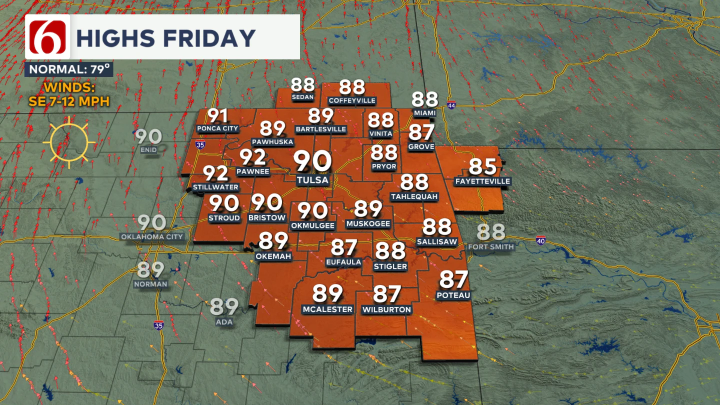
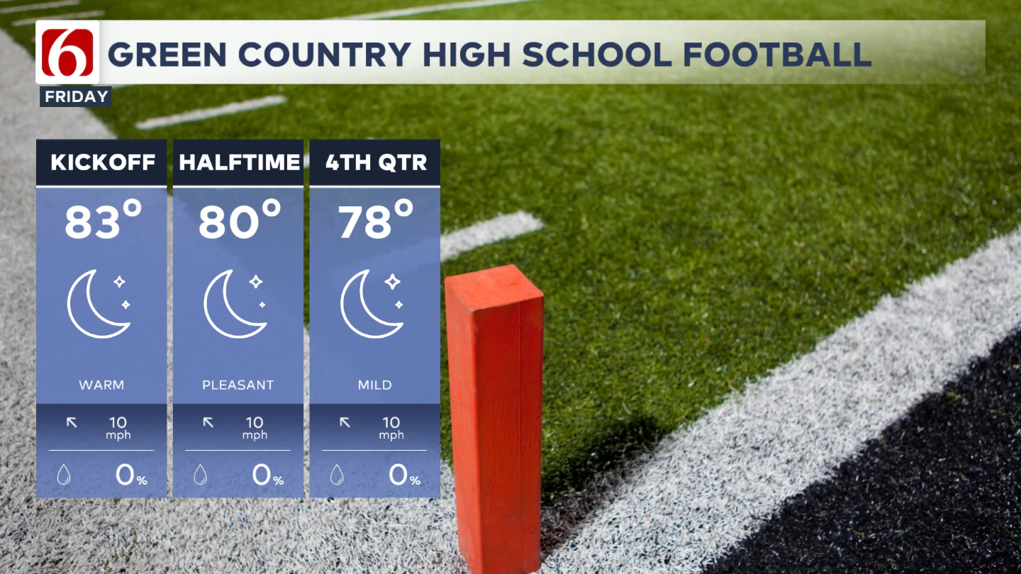
Highs will be back in the upper 80s to around 90 Friday afternoon with a light but steady southeast breeze. We'll have warm conditions Friday evening for high school football games.
Any chance for a weekend shower?
The short answer is no. An upper level trough will develop over the far western U.S. by Friday afternoon and begin moving east toward the central Plains by Sunday.
As it approaches, the ridge over our area will weaken and shift slightly, allowing a low-end chance for a few showers or storms, mainly across southwestern Kansas and possibly into northwestern Oklahoma.
The best window for any rain in this area appears to be heading into Monday. A weak boundary will be pushing into southern Kansas during this timeframe, but it appears fairly likely that the front will not make it to Green Country by early next week.
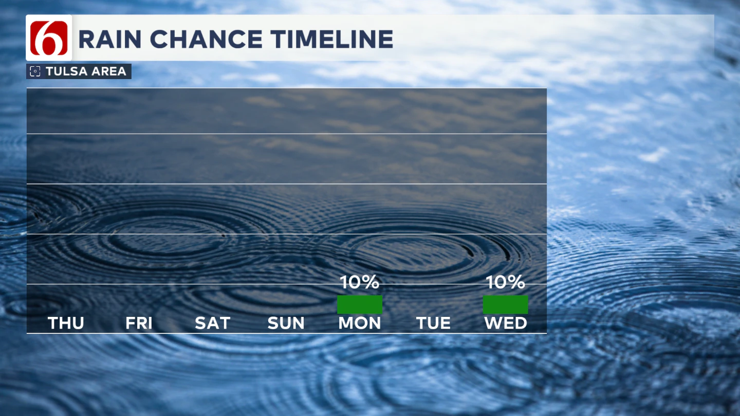
A few showers could drift out of southern Kansas into far northern Oklahoma on Monday as that weak front stalls out. By the middle to late portions of next week, a more noticeable weather pattern shift could be trying to develop.
Weekend Temperatures?
Temperatures over the weekend will remain above seasonal averages, with morning lows in the mid-60s and afternoon highs in the upper 80s.
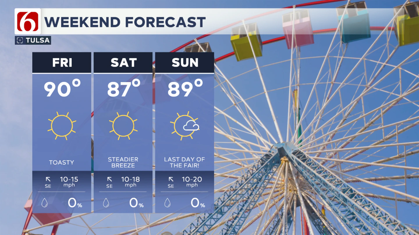
Southeast winds will increase Friday through Sunday, ranging from 15 to 20 mph as the pressure gradient increases.
Any Changes Next Week?
As we move into early next week, the ridge may briefly reestablish itself before weakening again. A stronger trough and associated cold front are expected to approach the region by Tuesday or Wednesday.
This system could bring a few storms and a modest cool-down, though significant cold air is not expected at this time.
What’s the Friday Night Football Forecast?
Games will kick off with temperatures in the lower 80s and wrap up in the mid to upper 70s. We'll have a light but steady southeast breeze around 10 mph.
College Football Weekend Lineup
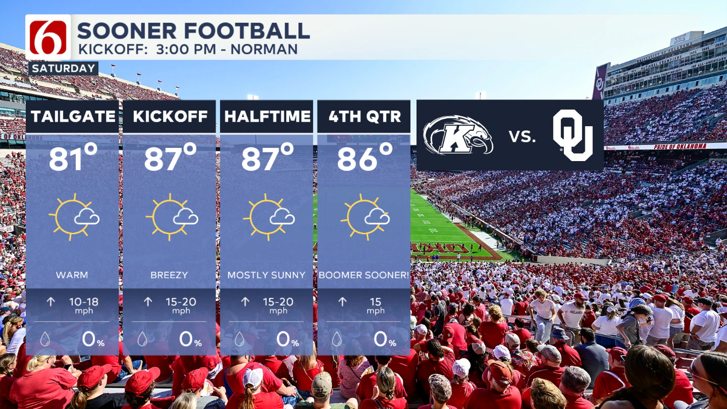
Kent State at University of Oklahoma
Location: Norman, OK
Kickoff: Saturday at 3:00 PM
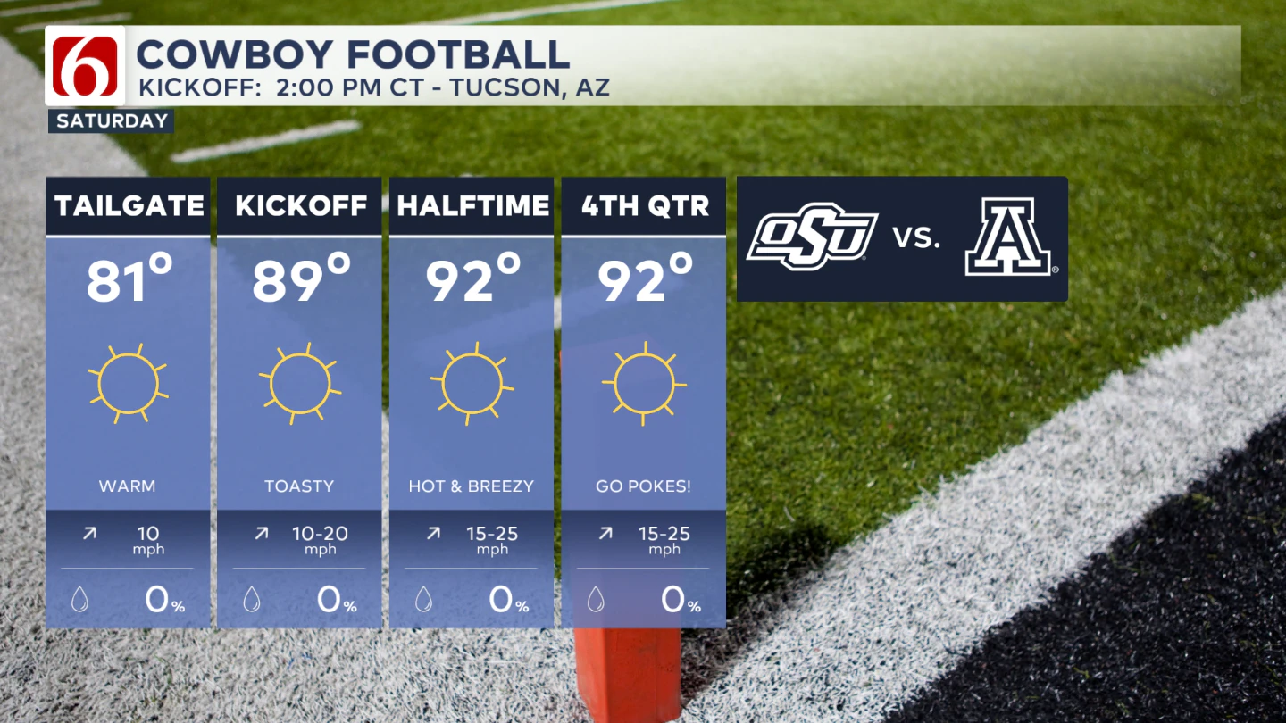
Oklahoma State at Arizona
Location: Tucson, AZ
Kickoff: Saturday at 2:00 PM CT
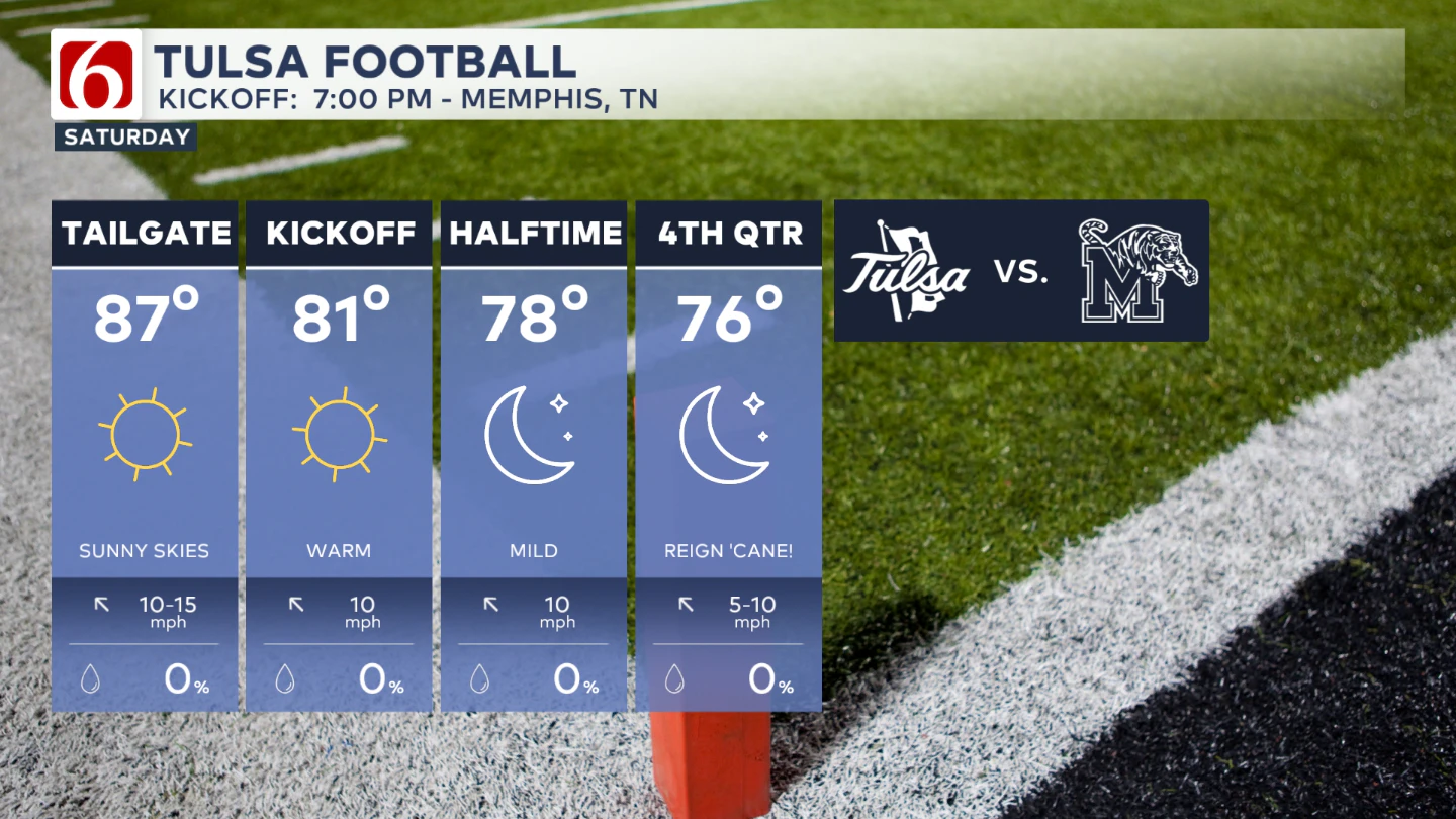
University of Tulsa at Memphis
Location: Memphis, TN
Kickoff: Saturday at 7:00 PM CT
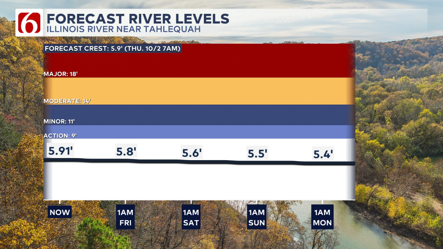
The Illinois River Near Tahlequah
The Morning Weather Podcast:
The daily morning weather podcast briefing will remain on hold indefinitely due to ongoing internal workflow issues.
We're working to resolve these challenges as soon as possible and appreciate your patience. We apologize for the inconvenience and hope to be back soon. Thank you for your understanding.
Need-to-know severe Oklahoma weather prep:
🔗Severe weather safety: what you need to know to prepare
🔗Tornado Watch vs. Tornado Warning: what they mean and what to do
🔗Severe weather safety: what to do before, during, and after a storm
🔗Why registering your storm shelter in Oklahoma could save your life
🔗Floodwater kills more Oklahomans than tornadoes in the last decade, here's why
🔗'Turn around, don't drown': Flood safety tips for Oklahomans
🔗5 things to know: How Oklahomans can get federal money to install storm shelters
🔗Breaking down the SoonerSafe Rebate Program: Do I qualify for a storm shelter?
Watch us on YouTube
Follow NewsOn6 on X/Twitter for automated severe weather alert posts: @NewsOn6
Emergency Info: Outages Across Oklahoma:
Northeast Oklahoma has various power companies and electric cooperatives, many of which have overlapping areas of coverage. Below is a link to various outage maps.
- PSO Outage Map
- OG&E Outage Map
- VVEC Outage Map
- Indian Electric Cooperative (IEC) Outage Map
- Oklahoma Association of Electric Cooperatives Outage Map — (Note: Several Smaller Co-ops Included)
