Tulsa weather: Storm Chances Climb Heading Into Midweek

Will Most Areas Stay Dry?
Most of the region will more than likely stay dry through the next few days, but a few of these pop up showers can’t be ruled out later this afternoon to cool a few of us off. The pattern continues to bring warm weather across northern Oklahoma, with daytime highs approaching the lower 90s. 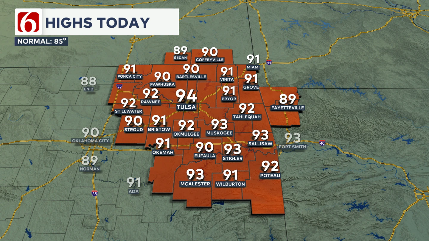 South winds will remain relatively light, around 5 to 12 mph, under mostly to partly sunny skies. A minor heat index will be possible.
A weak disturbance nearby, combined with low-level moisture and daytime heating, will lead to the development of a few scattered showers and thunderstorms by early afternoon. Some of these may produce locally heavy downpours and gusty winds between 40 and 50 mph. The threat of severe storms remains low, but not zero. 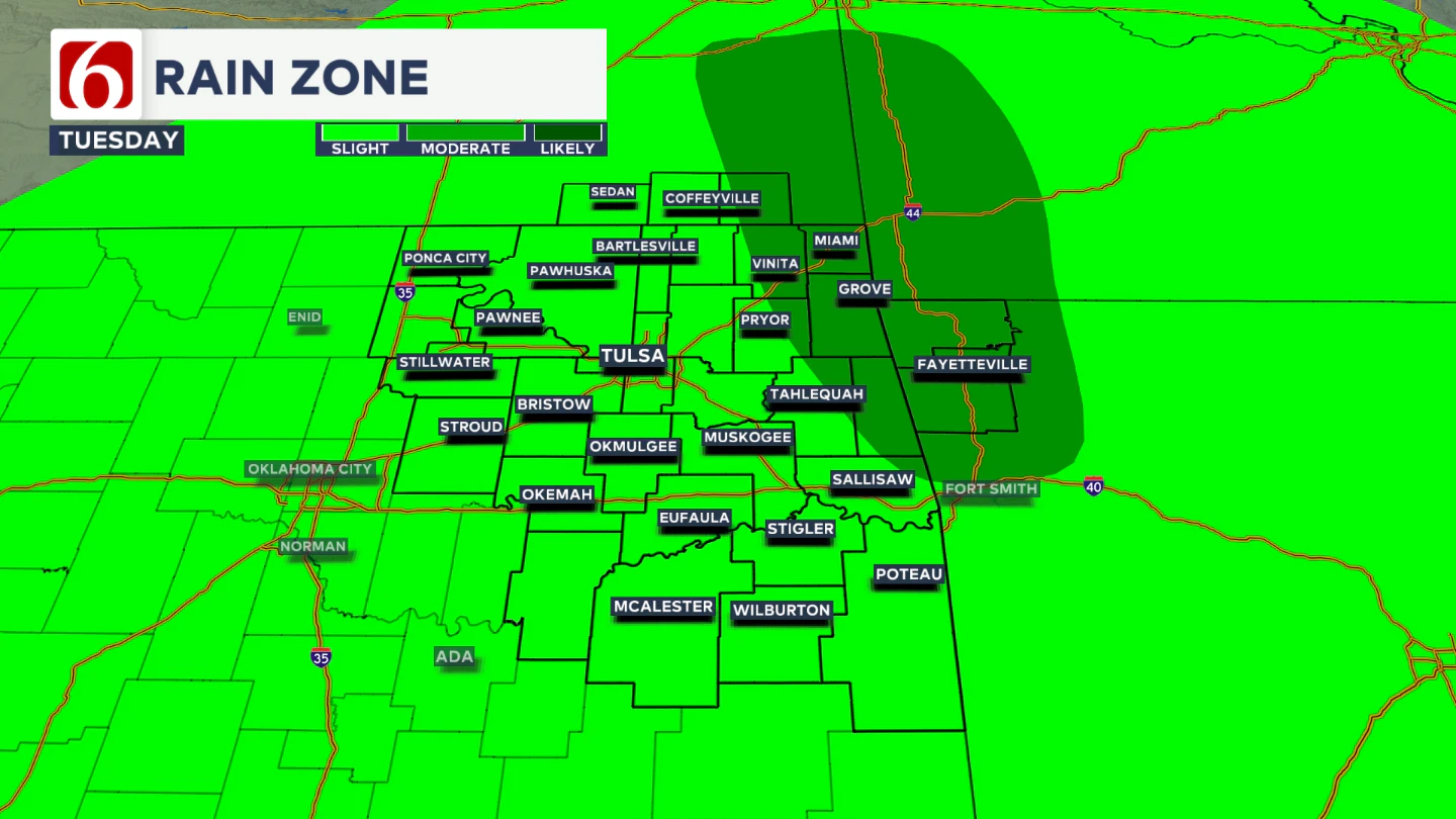 A slightly higher concentration of scattered showers and storms is expected today across extreme northeastern Oklahoma, southeastern Kansas, southwestern Missouri, and northwestern Arkansas. We’ll continue to carry a low-end mention of a scattered thunderstorm near the Tulsa metro later this afternoon. With the loss of daytime heating, most of these showers and storms will quickly dissipate, though the eastern side of the metro may hold a slightly higher chance. Most locations will remain dry, but the possibility is enough to warrant inclusion in the forecast.
When Will Rain Chances Increase?
No significant changes are anticipated in the midweek or weekend outlook compared to yesterday. Late Tuesday night into Wednesday, the mid-level ridge begins to weaken and shift away as the next trough develops across the western U.S. 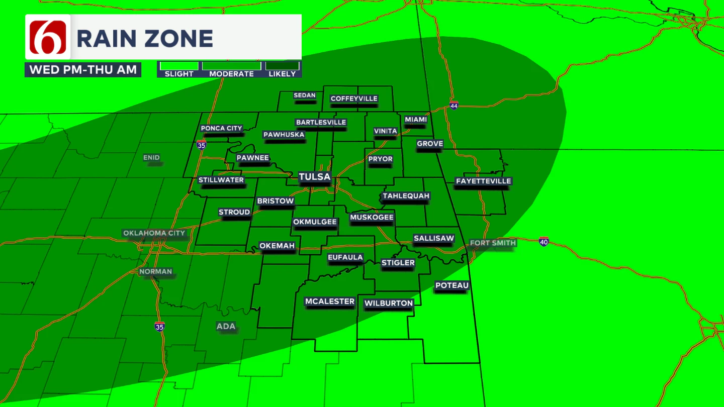 The upper air pattern will bring a disturbance near the central Plains, along with a surface boundary, resulting in additional shower and storm chances developing Wednesday.
 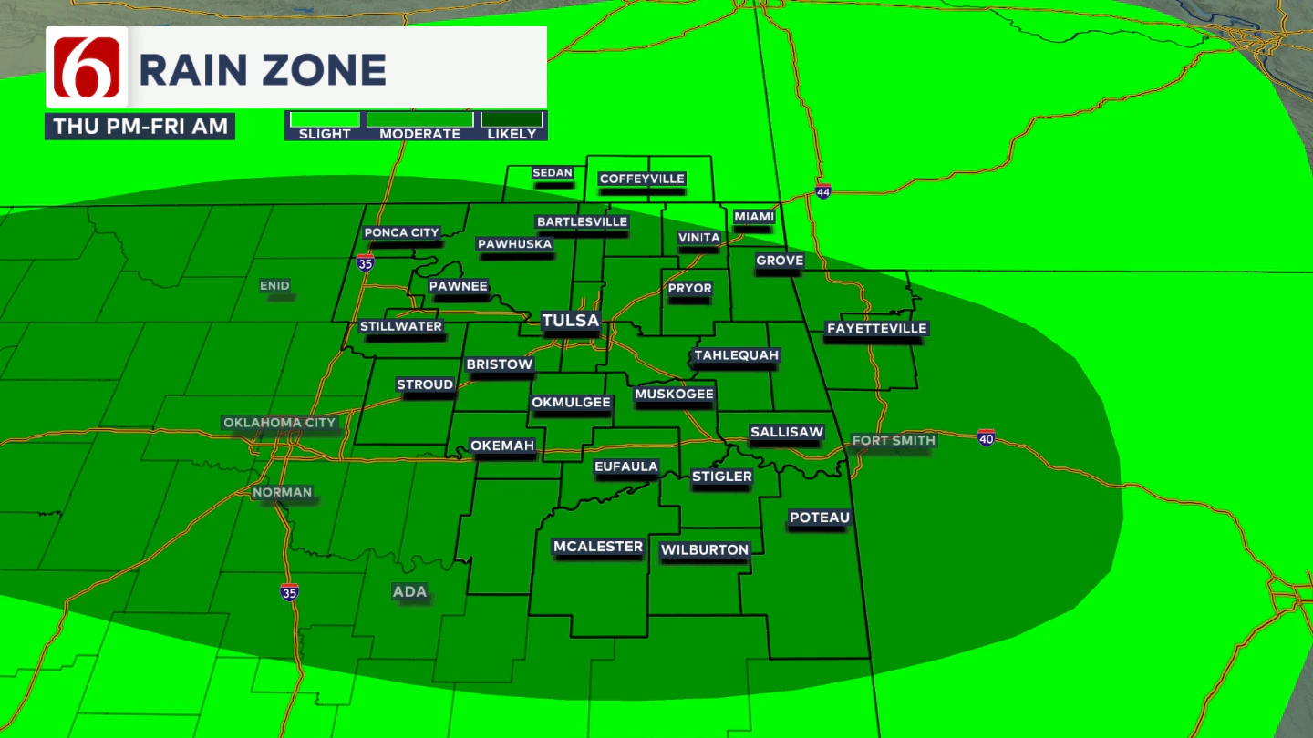 Thunderstorm coverage is expected to increase Wednesday night into early Thursday, and again from Thursday to early Friday. Pockets of heavy rainfall will be possible, and a few strong to severe storms cannot be ruled out.
Any Cooler Weather?
Wednesday’s highs will drop into the upper 80s to lower 90s with a light southwest breeze.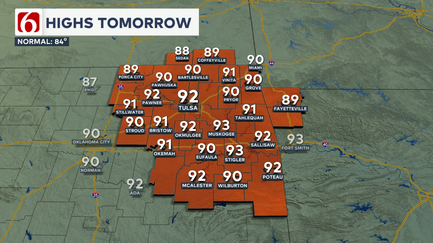
This should have an impact on the temps with more cloud cover and potentially some rain-cooled air in spots. Thursday morning will start in the mid to upper 60s, with highs in the lower 80s.
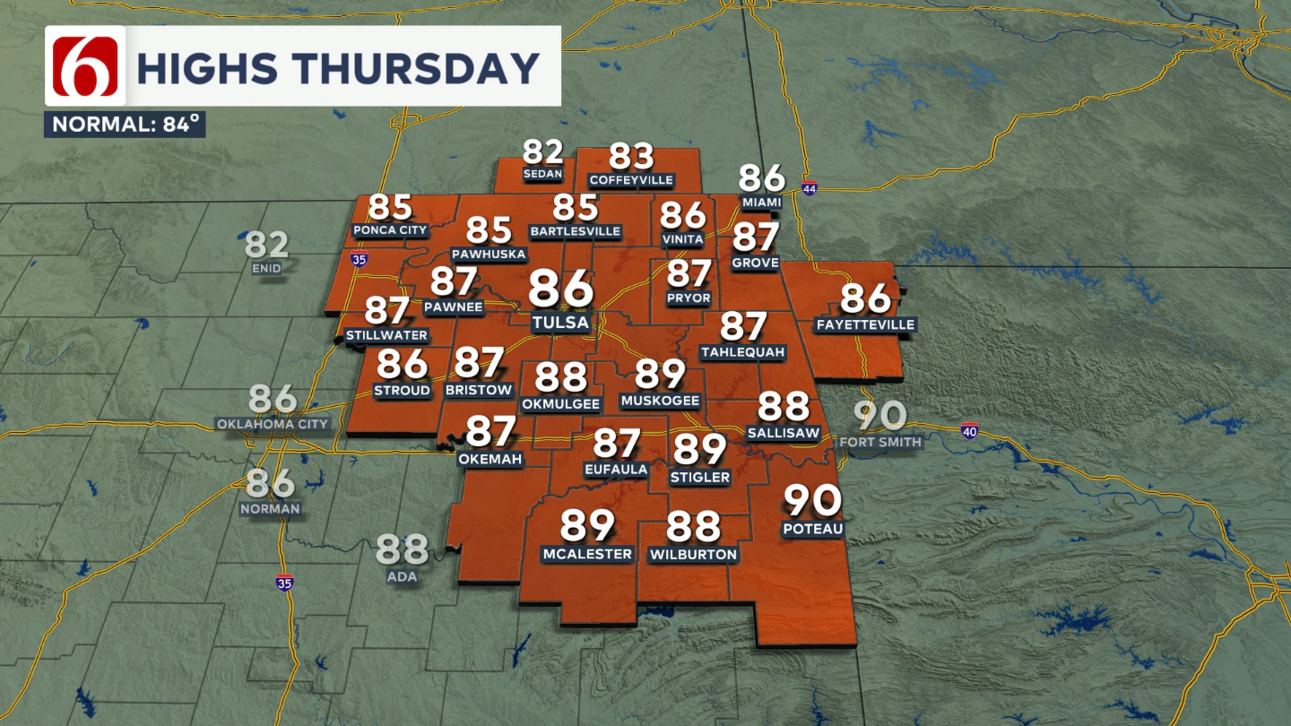
Friday morning temperatures will begin in the mid-60s, with highs climbing into the lower 80s.
What About The Weekend?
Looking ahead to the weekend, no major changes are expected. The upper-level flow will begin transitioning to a more northwesterly direction. This pattern tends to favor late-night and early-morning storm systems approaching the area. As of now, probabilities continue on the low-end, but some changes will be possible that could bring some higher chances Sunday.
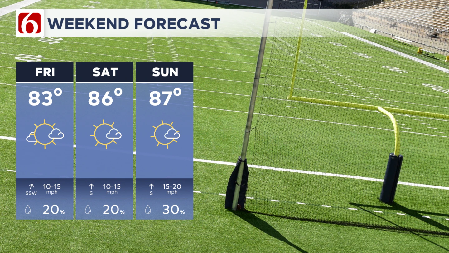
For now, our probabilities for rain and thunder will remain relatively low as confidence in the exact trajectory of any complex of storms remains low. Check this portion of the forecast later in the week, as some changes will be possible.
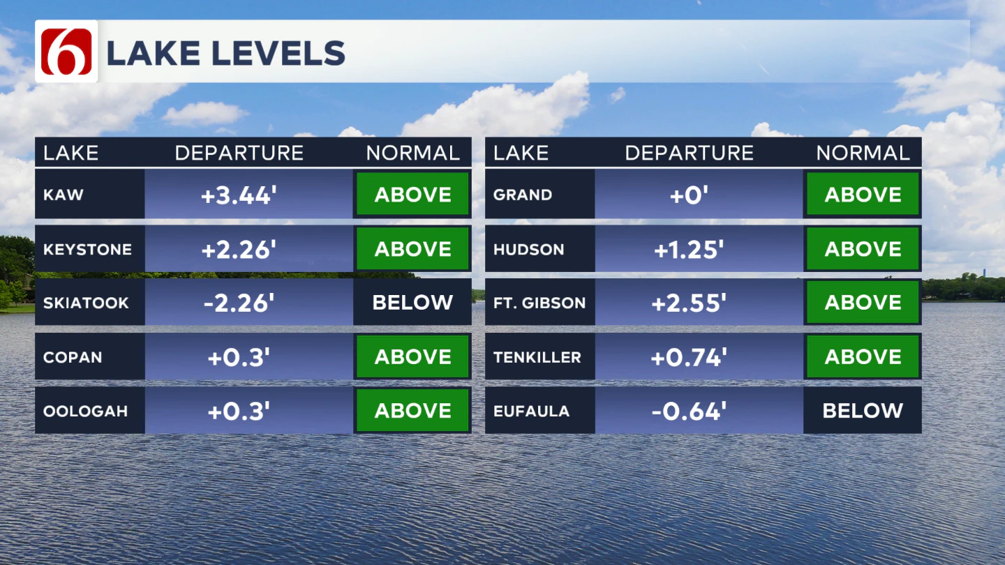
Lake Levels
If you're making some lake recreation plans, here's an update on our area lake levels. You can look up specific lake levels anytime on our website here: https://www.newson6.com/story/5e367cbd2f69d76f6208fbb6/oklahoma-lake-levels
The Illinois River Near Tahlequah 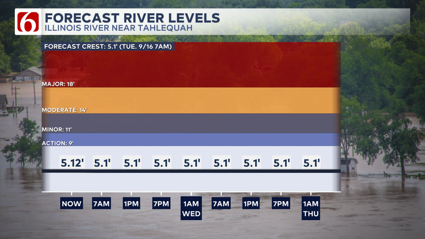
River levels should remain around 5' give or take a little bit though the next few days.
The Morning Weather Podcast:
The daily morning weather podcast briefing will remain on hold indefinitely due to ongoing internal workflow issues.
We're working to resolve these challenges as soon as possible and appreciate your patience. We apologize for the inconvenience and hope to be back soon. Thank you for your understanding.
Hot weather safety:
🔗 Oklahoma heat safety tips: How to spot and prevent heat illness
🔗 Top summer safety tips every family needs to know
🔗 'It can happen to anybody': First responders warn of hot car deaths
Need-to-know severe Oklahoma weather prep:
🔗Severe weather safety: what you need to know to prepare
🔗Tornado Watch vs. Tornado Warning: what they mean and what to do
🔗Severe weather safety: what to do before, during, and after a storm
🔗Why registering your storm shelter in Oklahoma could save your life
🔗Floodwater kills more Oklahomans than tornadoes in the last decade, here's why
🔗'Turn around, don't drown': Flood safety tips for Oklahomans
🔗5 things to know: How Oklahomans can get federal money to install storm shelters
🔗Breaking down the SoonerSafe Rebate Program: Do I qualify for a storm shelter?
Watch us on YouTube
Follow NewsOn6 on X/Twitter for automated severe weather alert posts: @NewsOn6
Emergency Info: Outages Across Oklahoma:
Northeast Oklahoma has various power companies and electric cooperatives, many of which have overlapping areas of coverage. Below is a link to various outage maps.
- PSO Outage Map
- OG&E Outage Map
- VVEC Outage Map
- Indian Electric Cooperative (IEC) Outage Map
- Oklahoma Association of Electric Cooperatives Outage Map — (Note: Several Smaller Co-ops Included)
